


The Fascinating Story Of Africa’s Fake Mountains Of Kong
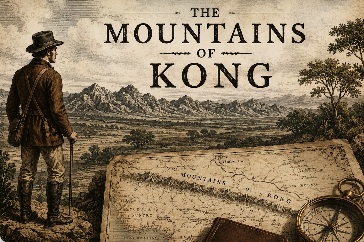
The mountain range stretched across the continent and was on maps for over a century.
The Scottish explorer Mungo Park first mentioned the magnificently named ‘Mountains of Kong’ in his book, Travels in the Interior Districts of Africa. On seeing the distant range, he wrote:
“[P]eople informed me, that these mountains were situated in a large and powerful kingdom called Kong.” (Source)
Park didn’t approach the mountain range any further, he just noted them down and continued exploring.
However, that note proved to be enough to establish them as fact. The legend of the range had begun.
The Mountains of Kong started to appear on maps
Based on Park’s report, renowned English cartographer James Rennell included the range on a map in 1798. Rennell had theories on the origins of the Niger River and its water basin. Drawing on his theories about how river systems worked, Rennell concluded the Mountains of Kong must stretch hundreds of miles inland, and that is what he drew.
The Mountains of Kong became better known after featuring in Aaron Arrowsmith’s Africa atlas in 1802.
Then, in 1804, they appeared on a map by the German Johann Reinecke.
The next year, the famous engraver John Cary created a link between the Mountains of Kong and the equally evocatively named Mountains of the Moon, forming a range that stretched across the entirety of the African continent. Below is what he thought the continent’s centre looked like:

The mountain chain had now been established as real and it was consequently included on most maps of the era. Historians Phillip Porter and Thomas Bassett have identified the Mountains of Kong on around 40 maps between 1798 and 1892.
The range’s popularity soon stretched beyond cartographers and out into popular culture.
Published in 1886, Jules Verne mentioned the range in his book Robur the Conqueror.
“In the morning of the 11th the Albatross crossed the mountains of northern Guinea, between the Sudan and the gulf which bears their name. On the horizon was the confused outline of the Kong mountains in the kingdom of Dahomey.”
Throughout the 19th century, cartographers, explorers and adventurers described the range in surprising detail. According to The Journal of African History:
“They were also believed to be rich in gold, covered with snow, and an ‘insuperable barrier’ hindering commerce between the coast and the interior.”
The mountains were frequently described as lofty, barren, and blue, with reported heights ranging from 2,500 to 14,000 feet. Some explorers even said they had crossed them. The mountains weren’t just the Niger’s source, but were also where the Gambia and Senegal rivers began.
Despite some explorers failing to find them, the Mountains of Kong were still treated as an established fact. But there was one significant problem with all these maps and descriptions.
The Mountains of Kong didn’t exist.
The range was proven fake, yet still kept popping up on maps
In 1888, Louis Gustave Binger, a French officer and explorer, was charting the course of the Niger River and reached the town of Kong. Much to his surprise, he found that no mountains were cutting off the south from the north. In fact, he discovered Kong was a trading hub for both regions.
The discovery that the Mountains of Kong didn’t exist started to lead to their disappearance from maps – but not entirely.
The range was included in Trampler’s Mittelschulatlas in 1905. They were also listed (but not shown) in the Oxford Advanced Atlas in 1928. However, that still didn’t mean the end of the myth, as the range made a final appearance in 1995 when they accidentally popped up in Goode’s World Atlas.
So how did this all come about?
Even allowing for the boastful nature of explorers and overly trusting cartographers, it is still not entirely clear how this all came about.
There is a range of hills near the town of Kong, although none are more than 700 feet above the surrounding land. It’s possible the generally reliable Mungo Park lost his sense of scale and thought they were further away than they actually were. He saw nearby hills and assumed they were far-off mountains.
Adding credence to this error was the renowned cartographer James Rennell, with his theories of a mountain range being the origin of the Niger River. It lent the error an air of scientific authority. It seems both Park and Rennell were so highly respected that their mistake lasted a century.
For more than a century, one of Africa’s most famous mountain ranges existed largely because respected men copied one another’s assumptions. Once the Mountains of Kong appeared on enough maps, they became the reality in the public imagination. Explorers carried those maps into the field, and when they saw the hills near Kong, the map told them what they were looking at. Perception followed expectation.
Sometimes, facts need to be checked.
This post has an affiliate link.